Things to Do in Berlengas: Beaches, Weather, and Map
Most people stare at the jagged silhouette of Berlenga Grande from the cliffs of Peniche and wonder if making the choppy crossing is worth the hassle. The Atlantic out here is unforgiving, churning over submerged reefs and battering pink granite walls that look like they broke off from an entirely different continent. If you decide to board the ferry, you will quickly find that the range of things to do in berlengas is defined almost entirely by raw elements, steep footpaths, and emerald water so clear you can count sea urchins six meters below your boat.
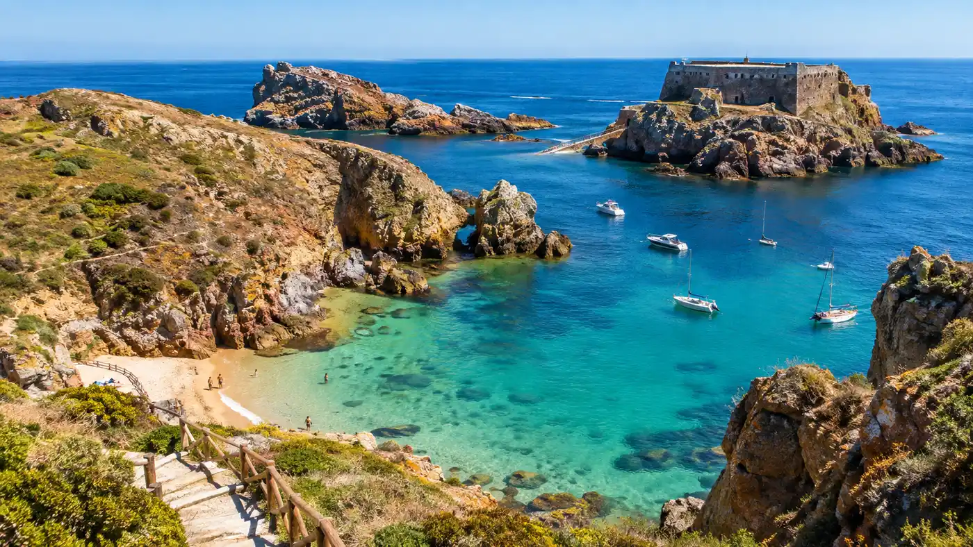
This tiny archipelago is an odd place. It has almost no trees, thousands of aggressive yellow-legged gulls, a dramatic 17th-century fortress linked by narrow stone bridges, and a microclimate that can swing from dense sea mist to blistering sunshine within forty minutes. You do not come here for luxury beach lounges or resort cocktails. You come to walk narrow ridgelines, scramble down to quiet coves, explore sea caverns carved by centuries of rough tides, and disconnect from the mainland completely.
Book your berlengas experience:
Where Is Berlengas Portugal and Understanding the Island Map
If you look at a mainland map, Peniche looks like a thumb jabbing westward into the cold Atlantic. Berlengas sits about 10 kilometers northwest of that thumb. People frequently ask where is berlengas portugal situated in relation to major hubs, and the short answer is that it sits about an hour and a half north of Lisbon by car, followed by a boat crossing across the unpredictable Óbidos trench. The archipelago consists of Berlenga Grande - the only inhabited landmass - alongside the smaller, strictly protected nature preserves of the Estelas and Farilhões islets, where civilian foot traffic is forbidden.
Studying a berlengas portugal map reveals how compact the main island actually is. Berlenga Grande spans roughly 1,500 meters in length and barely 800 meters across at its widest section. It is nearly severed in two by a pair of deep eroded coves, effectively dividing the island into Ilha Grande to the north and the smaller southern peninsula where you will find the lighthouse and the fortress. The official trails cover only a fraction of this terrain because the rest is reserved for nesting seabirds.
Navigating the terrain on foot is straightforward enough, though you cannot simply wander anywhere you like. Looking at the official berlengas mapa posted near the dock, you will spot two main marked trails, both leaving from the tiny fishing settlement known as the Bairro dos Pescadores. The Trilho da Berlenga takes you south across the high plateau toward the lighthouse and down the terrifying cliff steps to the fort, while the Trilho da Ilha Velha curls around the wilder, scrub-covered northern bluff. Straying off these painted trails is illegal, and the park wardens will happily hand you a fine if you disturb the vegetation.
Note: Berlenga Grande restricts daily visitors to 550 people at any given moment. You must register online for an official Berlenga Pass permit before booking your ferry ticket, or maritime police may turn you back at the Peniche marina.
The Top Things to Do in Berlengas: Exploring Forts, Trails, and Caverns
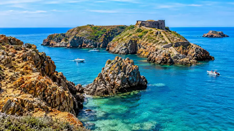
Walking toward the southwestern ridge brings you face to face with the reason most people make the boat journey. Sitting on an offshore rock outcropping, connected to the island by a series of arched masonry footbridges, is the fortress. If you take the time to visit Fort of São João Baptista in Berlengas, you will feel like you walked onto an abandoned movie set. Portuguese soldiers built it in the mid-1600s using stones salvaged from the ruins of a pre-existing Hieronymite monastery. The structure withstood pirate raids and Spanish naval bombardment, standing solitary against violent ocean spray. Walking across the stone bridge with heavy waves breaking underneath is an unforgettable experience, especially when the wind catches your jacket.
Beyond the fortress, spending half a day on the water lets you see the island from a much more intimidating angle. Small local skiffs navigate through submerged arches and tight caverns carved deep into the granite. The marine reserve preserves an incredible ecosystem, drawing divers and kayakers from all over Europe.
- Hike the Ilha Velha circuit: A four-kilometer walk looping the northern promontory, where you will see bizarre rock formations like the Elephant Trunk and carpets of coastal pink flowers in May.
- Take a small boat through Furado Grande: A marine cavern that forms a natural sea tunnel stretching over 70 meters straight through the granite belly of the island.
- Climb to the Duque de Bragança Lighthouse: Perched on the highest point of Berlenga at 121 meters above sea level, running entirely on solar power since 2000.
- Kayak the sea arches: Renting a sea kayak near the harbor lets you explore shallow inlets where large tour catamarans cannot fit.
The gulls will test your patience. Between April and July, they guard their nests aggressively, shrieking constantly from the rocks. Keep your head down and avoid getting close to fluffy chicks huddled near the path edges, or an angry parent will dive-bomb you without hesitation.
If you look into the water near the fortress landing, schools of sea bream hang suspended in the emerald tide. It feels almost tropical until you put your hand in and remember this is the mid-Atlantic.
Relaxing at Berlengas Beach: Praia do Carreiro do Mosteiro
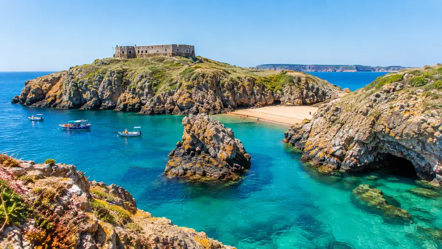
There is really only one true sandy beach on the island, but what a beach it is. Known locally as Praia do Carreiro do Mosteiro, this small crescent of golden sand sits tucked inside a deep, narrow canyon right below the old fishermen houses. Because the granite walls shoot up nearly vertical on both sides, the cove stays shielded from the howling westerly winds that often batter the top ridges.
The water at this berlengas beach is extraordinarily clear, shifting between pale jade and deep navy depending on the angle of the sun. Swimming here is stunning, though you need some courage to jump in. The water temperature rarely creeps above 17°C, even during late August heatwaves. It will take your breath away instantly. If you bring a cheap snorkel mask, swimming out just twenty meters from the shore reveals underwater boulders covered in sea anemones, wrasse, spider crabs, and small octopuses hiding in the cracks.
Pro tip: The beach is very narrow and high tide swallows roughly two-thirds of the sand. Head down immediately after the morning ferry drops you off to claim a dry patch against the back wall before the midday catamarans unload.
A paved walkway winds up from the sand directly to the small dock and the island restaurant. If the beach feels too cramped during peak summer afternoons, you can spread your towel out along the flat concrete landings near the harbor wall, where local kids spend hours leaping into the deep water.
Book your berlengas experience:
Berlengas Weather: What to Expect and When to Visit
The weather berlengas gets on any given day is entirely divorced from what you see on the mainland forecast in Peniche or Lisbon. You can wake up in Peniche under clear blue skies, drive to the harbor, and look out to sea only to find Berlengas completely smothered in a thick wall of white maritime fog. The local fishermen call it the nevoeiro de Peniche. It is caused by cold upwelling water meeting warm coastal air, and it often blankets the island until midday before burning off into harsh, blinding sunshine.
Packing for a trip here requires some strategy because the berlengas weather creates extreme swings. The Atlantic wind blows across the exposed plateaus almost constantly, making a 22°C afternoon feel brisk. Yet the moment you drop down into a sheltered cove like Carreiro dos Cações, the heat builds up rapidly against the stone. Sunburn is practically guaranteed if you forget sunscreen, as the pale granite and open sea reflect the ultraviolet light from every angle.
| Season | Air Temp Range | Water Temp | Sea Conditions | Crowd Density |
|---|---|---|---|---|
| May to June | 16°C - 21°C | 15°C - 16°C | Moderate swells | Quiet / Low |
| July to August | 19°C - 25°C | 17°C - 18°C | Generally calm | Peak capacity |
| September to October | 17°C - 22°C | 16°C - 17°C | Unsettled swells | Moderate |
| November to April | 11°C - 15°C | 13°C - 14°C | Rough / Dangerous | Closed to ferries |
Most boat operators run daily services from May until roughly the middle of October. Outside this window, winter storms generate towering waves that crash over the fortress bridges and make docking at the island pier impossible. Even in June, a sudden shift in wind can make the 45-minute ferry crossing rough enough to cause widespread motion sickness among passengers.
- Windproof jacket: Essential for the boat crossing and the exposed walking paths along the island ridgelines.
- Sturdy trail shoes: The granite steps going down to the fortress are uneven, worn smooth by sea spray, and dangerous in flip-flops.
- Seasickness medication: Take a tablet thirty minutes before boarding the ferry in Peniche, even if the sea looks flat in the harbor.
- Refillable water bottle: Fresh water is scarce on the island and prices at the small dockside cafe are steep.
Planning Food, Supplies, and Logistics on the Island
Berlenga Grande has minimal infrastructure, which is a big part of its charm. There is only one sit-down dining spot on the entire island: Mesa da Ilha, located near the main dock inside the old fishing settlement. They serve grilled sardines, fresh sea bass, and cold beer, but their kitchen operates on island time and tables fill up the second lunch arrives. If you do not have a reservation on a busy July weekend, you will waste two hours of your visit waiting for a table.
I usually pack my own picnic lunch instead. Grabbing bread, cured cheese, fruit, and tinned fish from a supermarket in Peniche saves money and lets you eat out on the rocks overlooking the open Atlantic. Just keep your bag zipped up tight. The local gulls have zero fear and will snatch a sandwich straight out of your fingers if you look away for three seconds.
You cannot leave your trash on Berlenga. Because it is a protected nature reserve with no municipal garbage collection trucks, all waste must be hauled off by the same boats that bring it in. Every wrapper, empty water bottle, and fruit peel you generate needs to go right back into your daypack until you return to the mainland.
Staying overnight is possible, though options are primitive. You can book a bed inside the historic fortress hostel, pitch a tent at the tiny terraced campground on the cliffside, or rent one of the very few spartan rooms operated by the local fishermen association. Space is scarce, so people book these beds months in advance.
Frequently Asked Questions about things to do in berlengas
How long should I plan to spend on Berlenga Grande?
A day trip lasting between four and six hours is plenty for most visitors. That window gives you enough time to hike both main footpaths, visit Fort of São João Baptista, spend an hour on the sand, and take a quick thirty-minute cave boat excursion before catching your ferry back to Peniche.
Can you visit Berlengas year-round?
Scheduled ferry companies run almost exclusively between May and mid-October. During the late autumn and winter months, violent Atlantic storms batter the rocky coast, and standard passenger boats stop running entirely. Only scientific researchers and park wardens brave the winter swells.
Is the boat ride to Berlengas rough?
Yes, it frequently catches people off guard. The passage crosses an open ocean trench where currents collide, creating unpredictable swells even on sunny days. Rigid inflatable boats (RIBs) make the trip in twenty bouncy minutes, while larger catamarans take around forty-five minutes with a slow, heavy roll.
Quick Reference
- Daily visitor limit: 550 people (permit required)
- Ferry crossing time: 20 to 45 minutes
- Average summer water temp: 17°C
- Primary hiking trail length: 3.5 kilometers
Book your berlengas experience:
The Bottom Line
Berlengas is not a manicured tourist retreat, and that is precisely why you should go. It is a harsh, salt-caked chunk of stone where the Atlantic dictates the rules and nesting seabirds hold dominion over the ridges. Grab your Berlenga Pass, slip a windbreaker and a snorkel mask into a backpack, and get out on the water before summer passes you by.
Read more about berlengas.